
படிமம்:Thailand location map Topographic.png

இந்த முன்னோட்டத்தின் அளவு: 341 × 600 படப்புள்ளிகள் . மற்ற பிரிதிறன்கள்: 136 × 240 படப்புள்ளிகள் | 273 × 480 படப்புள்ளிகள் | 437 × 768 படப்புள்ளிகள் | 582 × 1,024 படப்புள்ளிகள் | 2,000 × 3,517 படப்புள்ளிகள் .
மூலக்கோப்பு (2,000 × 3,517 படவணுக்கள், கோப்பின் அளவு: 10.24 MB, MIME வகை: image/png)
சுருக்கம்
| விளக்கம் |
Deutsch: Positionskarte von Thailand
Quadratische Plattkarte, N-S-Streckung 103 %. Geographische Begrenzung der Karte:
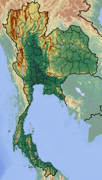
English: Location map of Thailand
Equirectangular projection, N/S stretching 103 %. Geographic limits of the map:
|
| நாள் | |
| மூலம் | சொந்த முயற்சி (backgroung : http://www.maps-for-free.com) |
| ஆசிரியர் | Dr Brains |
அனுமதி
இந்த ஆக்கத்தின் காப்புரிமையாளரான நான் இதனைப் பின்வரும் உரிமத்தின் கீழ் வெளியிடுகின்றேன்:

|
Permission is granted to copy, distribute and/or modify this document under the terms of the GNU Free Documentation License, Version 1.2 only as published by the Free Software Foundation; with no Invariant Sections, no Front-Cover Texts, and no Back-Cover Texts. A copy of the license is included in the section entitled GNU Free Documentation License. | 1.2 மட்டுமே |
|
|
Permission is granted to copy, distribute and/or modify this document under the terms of the GNU Free Documentation License, Version 1.3 or any later version published by the Free Software Foundation; with no Invariant Sections, no Front-Cover Texts, and no Back-Cover Texts. A copy of the license is included in the section entitled GNU Free Documentation License.
|
If this file is eligible for relicensing, it may also be used under the Creative Commons Attribution-ShareAlike 3.0 license. The relicensing status of this image needs to be manually reviewed by an experienced user. You can help.
|
நீர் உமக்கு விருப்பமான உரிமத்தை தேர்ந்தெடுக்கலாம்.
கோப்பின் வரலாறு
குறித்த நேரத்தில் இருந்த படிமத்தைப் பார்க்க அந்நேரத்தின் மீது சொடுக்கவும்.
| நாள்/நேரம் | நகம் அளவு சிறுபடம் | அளவுகள் | பயனர் | கருத்து | |
|---|---|---|---|---|---|
| தற்போதைய | 16:55, 12 சூன் 2012 | | 2,000 × 3,517 (10.24 MB) | Dr Brains |
கோப்பு பயன்பாடு
இப் படிமத்துக்கு இணைக்கப்பட்டுள்ள பக்கங்கள் எதுவும் இல்லை.
கோப்பின் முழுமையான பயன்பாடு
கீழ்கண்ட மற்ற விக்கிகள் இந்த கோப்பை பயன்படுத்துகின்றன:
- af.wikipedia.org-திட்டத்தில் இதன் பயன்பாடு
- als.wikipedia.org-திட்டத்தில் இதன் பயன்பாடு
- ar.wikipedia.org-திட்டத்தில் இதன் பயன்பாடு
- ast.wikipedia.org-திட்டத்தில் இதன் பயன்பாடு
- ban.wikipedia.org-திட்டத்தில் இதன் பயன்பாடு
- Taman Nasional Mu Ko Ang Thong
- Taman Nasional Laem Son
- Taman Nasional Kaeng Krachan
- Taman Nasional Khao Lak–Lam Ru
- Taman Nasional Kui Buri
- Taman Nasional Sai Thong
- Taman Nasional Si Phang Nga
- Kompléks Wana Dong Phayayen–Khao Yai
- Taman Nasional Thale Ban
- Taman Nasional Thong Pha Phum
- Taman Nasional Chaloem Phrakiat Thai Prachan
- Taman Nasional Chaloem Rattanakosin
- Taman Nasional Hat Khanom–Mu Ko Thale Tai
- Taman Nasional Kaeng Krung
- Taman Nasional Khao Laem
- Taman Nasional Khao Lampi–Hat Thai Mueang
- Taman Nasional Khao Phanom Bencha
- Taman Nasional Khlong Phanom
- Taman Nasional Khuean Srinagarindra
- Taman Nasional Lam Nam Nan
- Taman Nasional Mae Wa
- Taman Nasional Namtok Chet Sao Noi
- Taman Nasional Nam Phong
- Ban Chiang
- Taman Lelintihan Ayutthaya
- Kota Malelintihan Sukhothai miwah Kota Malelintihan Kakait
- ba.wikipedia.org-திட்டத்தில் இதன் பயன்பாடு
- bh.wikipedia.org-திட்டத்தில் இதன் பயன்பாடு
- bn.wikipedia.org-திட்டத்தில் இதன் பயன்பாடு
- bs.wikipedia.org-திட்டத்தில் இதன் பயன்பாடு
- ca.wikipedia.org-திட்டத்தில் இதன் பயன்பாடு
- ceb.wikipedia.org-திட்டத்தில் இதன் பயன்பாடு
- ce.wikipedia.org-திட்டத்தில் இதன் பயன்பாடு
- cs.wikipedia.org-திட்டத்தில் இதன் பயன்பாடு
சிறப்பு பக்கம்-மொத்த பயன்பாடு - இதன் மூலம் இந்த கோப்பின் மொத்த பயன்பாட்டை அறிய முடியும்